But let's start at the beginning of analyzing a day - I know my starting point (either home or the hotel), so the first step is getting out of town and headed in the right direction. Ride with GPS will come up with a route between two points, and I found that was a good starting point, but needed to be carefully examined. Especially in some of the less populated areas, it would tend to route me onto the gravel bike paths. Because of the additional time, wear and tear on my body, and possibly sketchy travel surface, I did my best to minimize these parts. If I needed to ride a bit farther, so be it.
Using the Google Map layer, as well as the Open Street Map layers on Ride with GPS, I had a good idea if I was going to be on a paved road or not. But the best case was having Google StreetView coverage to double check. StreetView doesn't really drive on dirt roads, so that was another good indicator of where to go.
I lived in Poland for three years and did plenty of bike riding, so I am under no illusion that the paved roads are going to be well paved. But it is definitely better than a gravel path.
If there are any major tourist attractions in the vicinity I might alter my route to see those. I can only think of one case where I actually did that, even after consulting my "Poland for Tourists" road map book.
So once I am getting around the 135km mark for the route, it is time to check the viability of hotel rooms. I used Booking.com exclusively for finding places to stay and their map made it easy to see if a place was near my route or on the wrong side of town. My criteria were pretty simple - WiFi and I would prefer an included breakfast. I also made a note to myself if there were grocery stores nearby so I can stock up on snacks and water.
Another thing to keep an eye on was the elevation change over a given route. If it was going to be hillier (like Day 1 and Day 3,) I purposely kept those days a bit shorter. However, it is pretty much flat to downhill for the rest of the route, thank goodness.
Planning out two weeks of riding took me about five days and definitely got faster when I was in more populated areas. I will probably look over the routes again before I go so I can make more detailed notes.
One resource I did consider using is the EuroVelo routes. This is a network that crosses Europe.
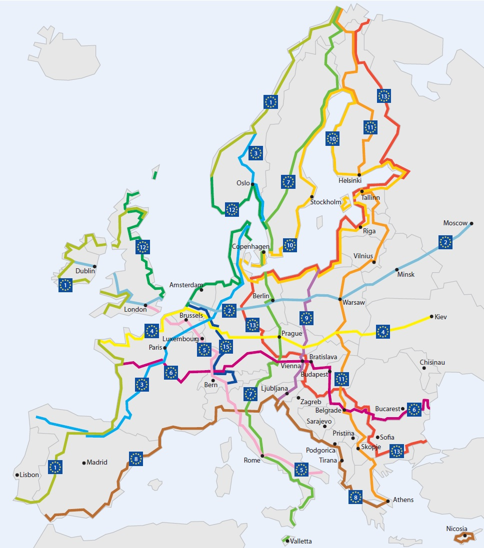
While this seems like a great idea, the reality is that in the Eastern European countries, these aren't necessarily mapped out very well or have posted signage. So trying to plan this from elsewhere became an exercise in futility.
So that gives you a snapshot of all the planning that went into this, but since I really like maps and overly planning out things, I really enjoyed doing this. We'll see how I feel about it when I am riding on a cruddy road in the middle of nowhere!
No comments:
Post a Comment